Tuesday, October 18, 2011

Alaska Marine Highway System: Part 4, Prince Rupert, B.C.

The Inside Passage is a protected waterway which is perfect for a person like me who is prone to seasickness. This is why I guide on a nice calm river.....However, there is one stretch between Ketchikan and Prince Rupert that is not protected by islands. As we passed through this area the ship definitely experienced a little bit of "rock and roll." It wasn't enough for my to feel queasy or to reach for the Dramamine. It was just enough for me to realize that how wonderful and smooth 95% of the trip was.
So, our final port of call was to Prince Rupert, British Columbia. It is known as the "Gateway to Alaska." I'm sure Canadians prefer to think of it as northern British Columbia's land, air and sea hub. It's definitely a bustling town with many fine restaurants and hotels. For some reason I thought Prince Rupert would be a dirty industrial, pulp mill kind of town, like so many towns in western Canada, so I was impressed with what I saw. It sure seems that I could spend several days here. This is probably in part due to the fact that that the Skeena River is here. The Skeena is a world class river known for its king salmon and steelhead run. My timing was off to fish this time, but next time......So, that's it. The end of our 34 hour Alaska Marine Highway excursion through southeast Alaska and northern Canada. I feel pretty comfortable that at our next sport show I can present this part of the state in an intelligent way (more than just book smart). It was definitely worth it for Jane and I to take this trip and would do it again in a heartbeat.

Alaska Marine Highway System: Part 3, Ketchikan


After we left Juneau, the M/V Taku made stops in Petersburg (Little Norway), and Wrangell. Considering the stops were made in the middle of the night I chose to sleep in my comfortable two berth cabin. We arrived in Ketchikan mid morning to load and unload passengers and vehicles. We only had an hour off of the ship so Jane and I decided to take a short walk around the harbor area. Definitely another beautiful Alaska coastal town.
Here's a view of Ketchikan as we came into port. What I noticed the most was the whirlwind of boats and floatplanes. Unlike Haines, Ketchikan is definitely not a a sleepy little town. People seemed to be in a hurry to get to somewhere and fast. Maybe there was a "hot bite" going on. Not an unreasonable conclusion considering Ketchikan has the title of "Salmon Capital of the World".
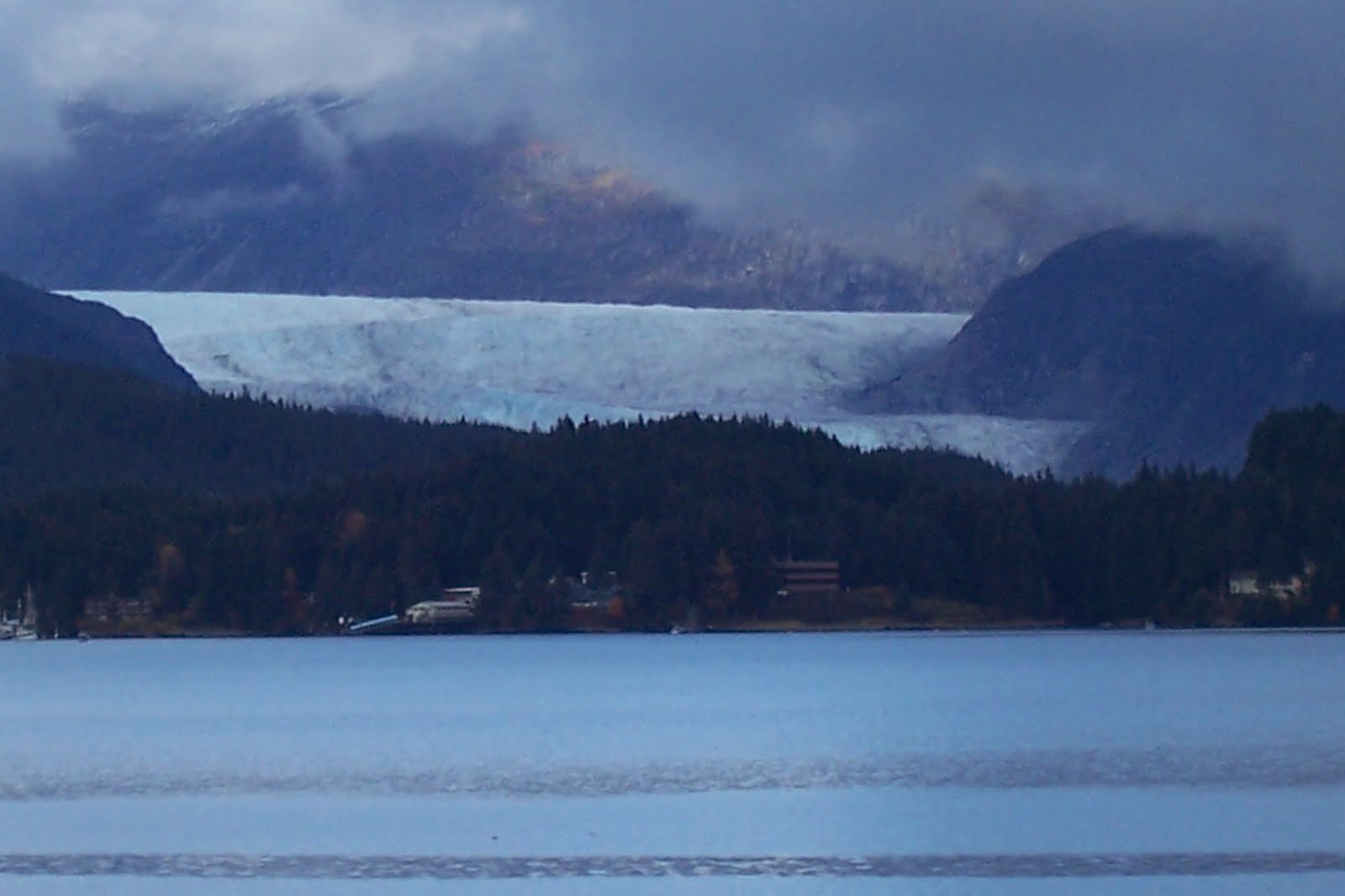
So after our brief stop in Ketchikan the last leg of our ferry trip took us out of Alaska and down to Prince Rupert, British Columbia, Canada. My final post will be about this gorgeous town.

Alaska Marine Highway System: Part 2, Juneau


After a beautiful four hour boat ride we arrived in Juneau. We spent the night and spent part of the next day traveling around the 45 miles of highway in and around our capital (population 30,500). Juneau is definitely different than I imagined and I mean that in a good way. The highlight of the stop was having breakfast with an old college roommate of mine from the University of Alaska-Fairbanks, Mark Stopha. We've kept up with each other off and on by email but the last time I actually saw Mark was just before he left on a Peace Corp mission to Sierra Leone in 1986. Naturally, 25 years later neither one of us has aged a bit. Ha!
In the afternoon we boarded the M/V Taku. This vessel can handle 370 passengers, 69 vehicles, and has 44 two to four berth cabins. It's was much larger than the M/V Taku and I'm sure it has to do with the fact that it's a 30 hour trip from Juneau to Prince Rupert, British Columbia. Before leaving port we asked a man from Chile if he would take our picture. Not the best lighting but it's from the 7th deck (solarium) of the ship.
As we left Juneau I took a picture of the only glacier that we saw on the whole trip. This is the Mendenhall Glacier and it is known as Juneau's "drive up attraction." I guess I was expecting to see more glaciers on our ferry trip but the Alaska Marine Highway System is all about efficiency and how to get from one port to another as quickly as possible. What I didn't realize is if you want to see glaciers you need to travel to side bays and arms along the way. This is what cruise ships like Princess and Holland America specialize in. Nonetheless, this is not a "deal breaker" and by no mean was I disappointed with the scenery along the ferry route.
One last photo from Juneau before I move on to the next port of call. This is facade of the State Capital building in downtown Juneau. Much, much smaller than what I'm use to seeing on Channel 2 news.

Alaska Marine Highway System: Part 1 Haines

As many of you know, Jane and I spend part of our winter working at sport shows promoting our business. The reality of working the sport show circuit is that we talk about all of Alaska and not just what we do. So, after years of "acting like experts" about Southeast Alaska and the Inside Passage we thought it was high time that we actually visited this area of the state. There are two ways to visit this part of Alaska: by plane or by boat. We decided to drive our vehicle to Haines, Alaska and get on a ferry and travel the Alaska Marine Highway System. The Alaska Marine Highway System has 11 vessels that travel over 3500 nautical miles. On an annual basis the ferry's accomodate over 300,000 passengers and 100,000 vehicles. Pictured above is the is M/V LeConte which we boarded for a 4 hour ride to Juneau. The vessel can accomodate 300 passengers and 34 vehicles.
We purposely arrived in Haines several hours before departure so we could explore. All I can say is what a great little town. We aren't the only one's who think that way. The writers of Outside magazine ranks Haines among the ten most desirable small towns in America.
I thought the Kenai Peninsula had quite a few bald eagles but the Chilkat Valley (Haines) has the largest congregation of bald eagles in the world. I don't know who counts the eagles but the population is estimated to be 3,500.
We stopped at the Haines Visitor Center to find out what else we should see while we were in town and we were told if we wanted to see brown bears we needed to drive down to the end of the road to Chilkoot Lake/River. I'm sure glad we did.
There were three brown bears working on the last few remaining chum salmon entering the river. It could easily be their last meal before a long winter of hibernation.
Just to give you an idea of how close we could view these bears, that's Jane's elbow in the upper left corner of the photo. This is the closest that either one of us has been to a brown bear and I'm not sure I'd want to be any closer.
After our bear viewing we boarded the M/V LeConte for a short 4 hour trip to Juneau. In my next post I will tell you about our time in Juneau.

Monday, October 3, 2011

The Dock is In

People often ask how we take our dock out. It's pretty simple. Wait for a really large tide, disconnect the floating section from the permanant wood section and then float it up to higher ground and let it sit there until spring. It takes all of five minutes to do this.
This is what the wood dock looks like when there's a 25 foot tide. As you can see, half of it is underwater.
And, this is what the front yard looks like when we experience a 25 foot tide. Simply amazing.

Final Fish Report--Week Ending 10/2/11

Well, the 2011 fishing season is officially over for me. I had a single trip this past week and the fishing was definitely on the slow side. Pictured above are Matt, Pat, Mike and Jake. Even though the weather and the fishing were marginal, their attitudes were definitely the highlight of the day for me. Thanks guys for ending my guiding season on such a positive note.
I did get a chance to go out and fish several times on my own this past week. Here's Jane posing proudly with a 15lb silver. On this particular day the weather was a bit cool but not raining. Jane asked if we could go out and see if there were any fish around. There were, we caught our limit, and the best part of the afternoon was the fact we were the only boat out on the lower river. It's times like these that make the Kenai River magical. I'm sad to see it end.....
Well, that's a wrap. You won't see a current Kenai River fishing report until May of 2012. Make sure to check the blog often because I plan to post on a weekly basis. Thanks for reading!